tdk logo

#TRUSTED TECHNOLOGY

How It All Works

#TRUSTED CORE

Inertial+: The Core of Everything We Do

Inertial sensors are the backbone of all our technology solutions because they are the only always-on positioning sensors. Continuous and reliable, these systems provide positioning information everywhere. These sensors, combined with other absolute sources, such as geomagnetic or wireless signals, provide accurate and affordable positioning in all environments.

Not one single location technology can provide accurate and reliable location information in all environments; therefore, we gather data from all available sources to filter out erroneous measurements and determine the most accurate position.

Regardless of the application or use case, our objective is to enable high quality positioning performance at a price feasible for large scale implementation.

#TRUSTED INDOORS

How VENUE Works

A mobile device and indoor map are all that is needed to create an indoor positioning solution with VENUE. Using the built-in inertial and magnetic sensors, VENUE tracks the movement of a person or wheeled platform indoors using geomagnetic positioning, inertial navigation and other wireless signals or opportunity. VENUE integrates all sources of infrastructure-free positioning technology to achieve an average accuracy of 1-3m.

#TRUSTED MOBILITY

How RIDE Works

RIDE obtains accurate positions, orientations and rider dynamics of 2-wheeled platforms through the integration of inertial sensors and GNSS inputs. Low-cost MEMS sensors, such as accelerometers and gyroscopes, are low-power and always-on. These MEMS inertial sensors detect movement, driver dynamics, rough usage, drop off position and fall detection. Used in tandem with GNSS updates, these inertial sensors can filter GNSS multipath and save power by only turning GNSS on when movement is detected for authorized usage or unauthorized removal. The INS algorithms for RIDE have been specially tuned and adapted for 2-wheel dynamics.

#TRUSTED NAVIGATION

How TRACK Works

Using inertial MEMS sensors and GNSS, TRACK provides enhanced vehicle positioning in the most challenging environments. The inertial core of accelerometers, gyroscopes continuously tracks the relative movement of the vehicle and uses GNSS information as absolute updates when available. In tunnels, or areas where GNSS becomes unreliable, the inertial core filters out erroneous data and provides reliable positioning without GNSS. Calibration and misalignment is all done automatically through typical driving motion.

#TRUSTED AUTONOMY

How AUTO Works

The integration of an automotive-grade IMU, vehicle speed, high accuracy GNSS, and perception sensors enables high accuracy, high integrity, and lower cost positioning for autonomous wheeled platforms. World class inertial navigation has improved INS-only performance by a factor of 10x over previous generation INS. Tight integration with imaging radar and GNSS enables decimeter level positioning in urban, residential and other challenging GNSS environments.

Definitions

INS consists of the algorithms that transform raw accelerometer and gyroscope data into positioning information. INS is by definition relative to another positioning reference, such as GNSS.

Global Navigation Satellite System consists of several constellations, including GPS. A GNSS receiver can provide accurate and absolute positioning if it sees several satellites. A clear view to the sky helps improve accuracy and availability.

Buildings are constructed of steel and other materials that interact with the Earth’s magnetic field; therefore, creating a unique magnetic field that can be surveyed and referenced to give precise indoor positioning information.

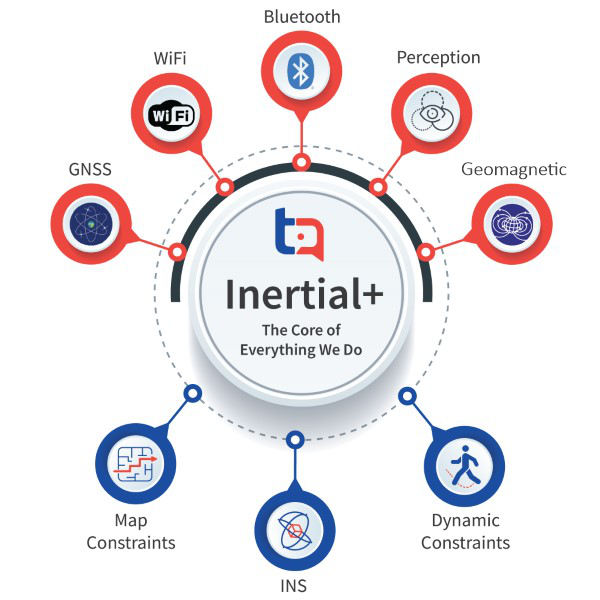
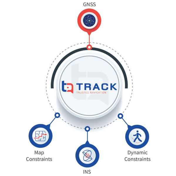
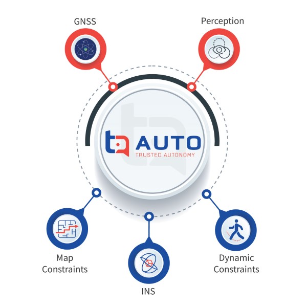
Perception sensors, such as radar, cameras and lidar, transmit signals into the surrounding environment and through the detection of echoes can determine the location of objects in the signals path. They are typically used for obstacle avoidance but can also be leveraged for positioning.

Wheel readings or engine RPM’s can be used to derive vehicle speed as one more input of velocity information that can ensure the accuracy of positioning information.